
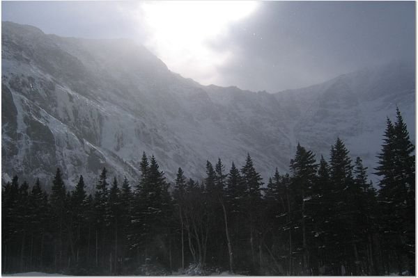
A view from Chimney Pond; photo credit: Bill Steinmetz
Katahdin: last winter I learned this name the first time. I was sitting in a cozy restaurant surrounded by my fellow winter hikers, enjoying the early hot coffee with a giant blueberry pancake, I overheard that the hike leader, Bill, was to attempt Katahdin in a few weeks. “Katahdin? What is it? Is it a trail and…where is it?†I couldn’t suppress my curiosity arisen from my adventurous blood. “It seems like some nice place to go,†I drew this conclusion based on the mild commotion observed from the group, “and…it must be a place to go if it requires Bill to train for it.â€
The second time I heard Katahdin, was on a bus ride to NOLS headquarters in Palmer, Alaska. The bus driver moved to Alaska many years ago from Maine. She described how much she was in love with the mountains in Alaska and she mentioned Katahdin when she laid Alaska and Maine in parallel for comparison. At that moment, Katahdin won its place in my to-do list. But not until I started to plan it last November, did I realize that this trip was to be a great one!
Several factors contribute to the difficulty of this trip:
1. Katahdin is remote. It is located in Baxter State Park and in the winter time roads in the park are not plowed. Before we reach the base camp, the Chimney Pond campground, we have to do 12 miles of road walking and 3.3 miles of trail hiking.
2. Winter conditions can be brutal. In addition to subzero temperatures and possible icy terrain, the most haunting part about Katahdin is the unpredictability of its orographic weather – especially the violent, merciless gusts. Wind can deteriorate visibility which will challenge climbers’ navigation skills. Wind chill makes heat preservation substantially difficult and frostbites and other cold-related injuries are more likely to occur.
3. Terrain is unfavorable. From Chimney Pond there are several trails that lead to the summit. Steep ones are more difficult and depending on the conditions, it might require us to set up a safety system. Gentler trails are avalanche prone – we need to be equipped with avalanche beacons, shovels, and probes and mostly importantly we need to know how to use them effectively.
To plan a winter Katahdin trip, there are many regulations to follow. For example, four is the minimum group size; a winter trip registration form is required to come in the park headquarters two weeks (preferably 4 weeks or earlier) before your trip. In the form, a group needs to specify a leader and two assistant leaders along with their winter experience and the leader has to sign his/her name so that “s/he attests that to the best of his/her knowledge, all members are capable and fit enough to ensure their safe completion of their proposed itinerary.†I always do my best when I lead a trip but this signature certainly will remind me the weight of the responsibility.
Perhaps after all I will find myself overly concerned. The trip is scheduled in early March, and it will be a seven-day trip, including two days of driving, four days of climbing and a one day window to enhance our chance of reaching the summit. Considering global warming, although the point is to do a challenging winter trip, in March we probably will encounter spring conditions and we don’t have to worry about avalanches. The drawback of spring conditions is possible wet and icy terrain and we will not be able to haul sleds for the 12 miles of road walking. Of course, it’s still two months away, and we can’t predict the conditions right now. What we can do is as usual – hope for the best and prepare for the worst.
If you want to plan your Katahdin trip, here are some references I’ve used:
1. Baxter State Park: It’s imperative that you study this site as thoroughly as possible, especially the “winter camping†section under “Camping and Reservation.â€
2. A trip journal written by Bill Steinmetz: Bill describes in great detail about his group’s approach of last winter. I have learned precious experience by reading this journal and by talking with him.
3. Maine Mountain Guide. 9th Edition. AMC Guide to Hiking Trails of Maine, Featuring Baxter State Park.
Katahdin,第一次è½åˆ°é€™åå—,是去年冬天。被眾多冬å£å¥è¡Œè€…åœç¹žè‘—,我在一個略嫌æ“æ“ çš„æ—©é¤åº—,啜飲著熱騰騰的咖啡,嚼著暖暖的è—莓蛋餅,耳邊傳來該日的雪鞋å¥è¡Œé ˜éšŠBillå³å°‡åœ¨æ•¸é€±å¾ŒæŒ‘戰Katahdin的消æ¯ã€‚「嗯,Katadin?什麼地方?是æ¥é“å稱嗎?好玩嗎?在哪裡?ã€é«”ä¸æ»¾è‘—冒險血液的我,按æºä¸ä½æ´¶æ¹§çš„好奇心,批哩啪啦地å•äº†è‡ªå·±å¥½äº›å•é¡Œã€‚çœ‹è‘—ç¾¤çœ¾å› é€™æ¶ˆæ¯è€Œå¼•èµ·çš„些許騷動,我想,這Katahdin一定是個好地方,è¦ä¸ç„¶Bill為什麼還è¦åŠ 強體能訓練呢?
第二次è½åˆ°Katahdin這個åå—,在去年å¤å¤©ã€‚å‰å¾€NOLS在Palmer, Alaskaçš„æ ¹æ“šåœ°é€”ä¸ï¼Œå’Œå·´å£«å¸æ©Ÿå°è©±ï¼Œå¥¹æ•¸å¹´å‰ï¼Œå¾žç·¬å› å·žæ¬åˆ°é˜¿æ‹‰æ–¯åŠ ã€‚å¥¹è«‡è‘—å¥¹æ˜¯å¦‚ä½•å¦‚ä½•åœ°æ„›è‘—é˜¿æ‹‰æ–¯åŠ çš„ç§€éº—å±±è‰²ï¼Œæ¯”è¼ƒå®¶é„‰å’Œé˜¿æ‹‰æ–¯åŠ çš„å°è©±ä¸ï¼Œå¥¹æåŠKatahdin。我望著窗外的山景,想åƒè‘—Katahdin該是怎麼個樣å,那一刻,Katahdin排進了個人è¦çˆ¬çš„山峰列表。ä¸éŽï¼Œä¸€ç›´åˆ°åŽ»å¹´å一月,真æ£é–‹å§‹è¨ˆç•«å¾€Katahdin的行程,我æ‰äº†è§£ï¼ŒKatahdin,其實是件大工程。
冬å£Katahdin行程之所以困難,主è¦åœ¨ä¸‹åˆ—幾點:
一ã€Katahdin略嫌åé 。
Katahdinä½æ–¼Baxter州立公園內。冬å£æ™‚,園內的é“路是ä¸å‰·é›ªçš„。所以在抵é”攀登Katahdinçš„base camp,也就是Chimney Pond營地之å‰ï¼Œè¦æ”œå¸¶è£å‚™è¡Œèµ°å二英里的é“路,和3.3英里的æ¥é“。
二ã€å†¬å£çš„天候æ¢ä»¶åš´è‹›ã€‚
除了經常低於è¯æ°é›¶åº¦çš„氣溫,以åŠå¯èƒ½çµéœœã€çµå†°å®¹æ˜“打滑的æ¥é“以外,Katahdin最å¯æ€•çš„地方在於該地氣候的多變難料,尤其是ä¸æ™‚刮來的強風。風勢å¯ä»¥è®“能見度大幅é™åœ°ï¼Œè€ƒé©—攀登著的辨路能力。åŒæ™‚強風考驗攀登著ä¿æŒèº«é«”溫暖的功力,很多寒冷相關的病症,åƒæ˜¯å‡å‚·ï¼ˆfrostbites)或是低溫症狀(hypothemiaï¼‰ç™¼ç”Ÿçš„æ©ŸçŽ‡éƒ½å¤§å¹…å¢žåŠ ã€‚
三ã€ç™»å³°æ¥é“挑戰性高。
從Chimney Pond,有數æ¢ä¸åŒçš„上峰路線。較陡å³çš„路線難度高,如果冰雪的狀æ³ä¸ä½³ï¼Œéœ€è¦è¨ç«‹å®‰å…¨æŽªæ–½ã€‚較平緩的路線則å¯èƒ½æœ‰é›ªå´©å±éšªï¼Œçœ¾äººå¿…é ˆæ”œå¸¶å› æ‡‰é›ªå´©çš„è£å‚™ï¼ŒåŒ…括信號器(avalanche beacon)ã€é›ªå‰·ï¼ˆsnow shovel)ã€æŽ¢æ¸¬å·¥å…·ï¼ˆprobe)ç‰ï¼Œæ›´é‡è¦çš„是,隊ä¼ä¸æ¯å€‹äººï¼Œéƒ½éœ€è¦çŸ¥é“如何有效率地使用該些è£å‚™ã€‚
å¦å¤–,籌畫Katahdin行程,Baxterå·žç«‹å…¬åœ’é–‹å‡ºäº†å¾ˆå¤šå¿…é ˆéµå®ˆçš„è¦å‰‡ã€‚åƒæ˜¯ï¼ŒéšŠä¼è‡³å°‘需è¦æœ‰å››äººã€‚填寫冬å£ç”³è«‹è¡¨çš„æ™‚å€™ï¼Œé™¤äº†é ˜éšŠä¸€äººï¼Œé‚„éœ€å ±å‚™å‰¯é ˜éšŠäºŒäººï¼ŒåŒæ™‚詳述這三人的冬å£ç¶“é©—ã€‚é ˜éšŠé‚„å¿…é ˆç°½å,ä¿è‰å…¶äº†è§£é€™å€‹è¡Œç¨‹çš„難度,åŒæ™‚隊ä¼çš„人身體狀æ³å’Œç™»å±±æŠ€å·§è‰¯å¥½ï¼Œæœ‰èƒ½åŠ›å®‰å…¨åœ°å®Œæˆæ‰€è¨ˆç•«çš„行程。æ¯æ¬¡å¸¶éšŠï¼Œæˆ‘知é“我都盡我所能åšåˆ°åšå¥½ï¼Œä¸éŽé€™æ¬¡é€™å€‹å一簽下去,似乎更感覺到責任的é‡é‡ã€‚
也許我是éŽåº¦æ“”心了也說ä¸å®šã€‚這個行程安排在三月份,長é”七天,包括兩天的往返交通,至少四天å¥è¡Œæ”€ç™»ï¼Œå†åŠ 一天的ç‰å¾…ç·©è¡ï¼Œä»¥å¢žåŠ ç™»é ‚æ©Ÿæœƒã€‚æžä¸å¥½å› 為溫室效應的緣故,雖然我們計畫冬å£æ”€ç™»ï¼Œåˆ°æ™‚候變得åƒæ˜¥å£å¥è¡Œä¹Ÿèªªä¸å®šã€‚ä¸éŽæ˜¥å£å¥è¡Œçš„壞處是,æ¥é“å¯èƒ½å¾ˆæ¿•æ»‘,åŒæ™‚也ä¸èƒ½åœ¨é‚£å二英里的路上,把部分è£å‚™æ”¾åœ¨é›ªæ’¬ä¸Šæ‹‰è‘—走了。當然,ç¾åœ¨ç•¶ç„¶ä¸èƒ½é 見三月的æ¥é“ã€å¤©å€™ç‹€æ³ï¼Œæˆ‘們åªæœ‰ä¿æŒå¹³å¸¸å¿ƒï¼Œåšæœ€å£žçš„打算,åšæœ€å¥½çš„期待。
å¦‚æžœä½ æƒ³è¦è¨ˆç•«å†¬å£Katahdin的行程,以下是我使用的åƒè€ƒè³‡æ–™ï¼š
1. Baxter State Park: é€™ä»½æ˜¯å®˜æ–¹è³‡æ–™ï¼Œå¿…é ˆç²¾è®€ã€‚å°¤å…¶æ˜¯ã€ŒCamping and Reservationã€ä¸‹çš„「winter campingã€éƒ¨åˆ†ã€‚
2. Bill Steinmetz所寫的行程記錄: 這是Bill寫的行程記錄,詳載去年冬å£ï¼ŒBill的團隊攀登Katahdin的所有éŽç¨‹ã€‚我從閱讀這份資料以åŠèˆ‡Bill的討論ä¸ï¼Œç²ç›Šè‰¯å¤šã€‚
3. Maine Mountain Guide. 9th Edition. AMC Guide to Hiking Trails of Maine, Featuring Baxter State Park.
Sounds fun, good luck!
Wow, I dont know much about climbing or Maine, but that picture is Awesome!
Looks like it would be a great time.
Scott
http://www.ghilliesuitsource.com
Pingback: Final Frontier: An Outdoor Blog » Blog Archive » Katahdin – We’ll Be Back